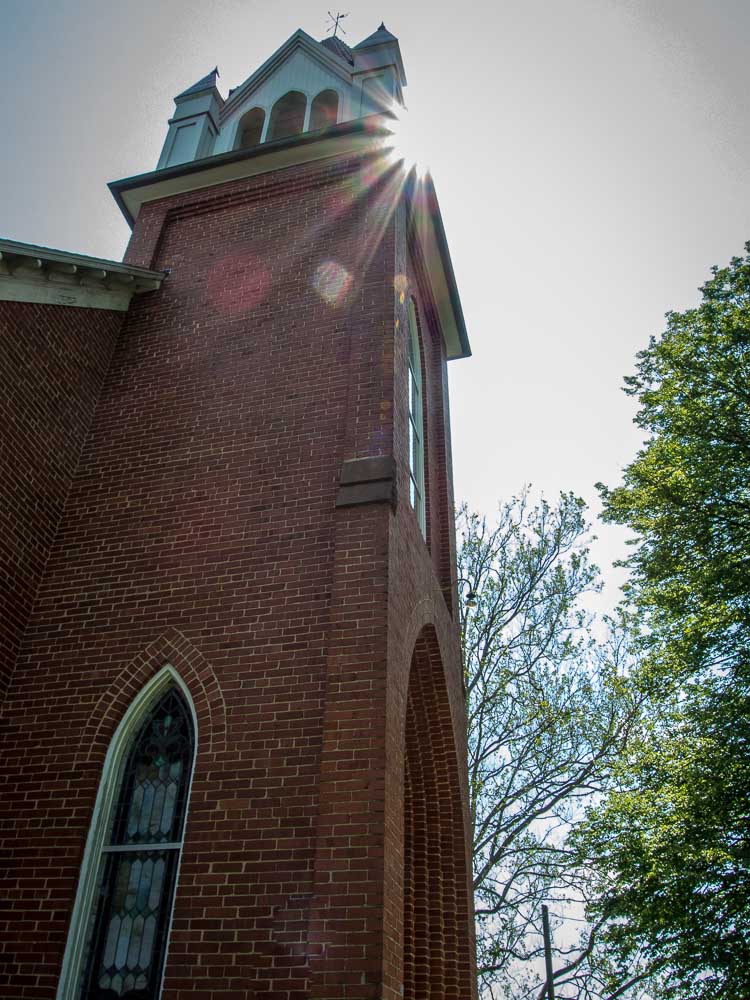
Friday, May 24, 2013

Day 264 - Old National Pike District Park

(Click any photo to enlarge.)

***Scroll down to see my offer for Red Cross donations.***

No Smurfs at home today.
False "blossoms" in the woods.
On this chilly and windy day, all I really wanted to do was to stay inside, curled up with my book and a cup of tea.  But I reminded myself that I have walked in  much worse weather, and in my opinion, chilly/windy is better than 98 degrees with high humidity, so I turned off the Kindle and went to the park.

Tulip Poplar Blossom on Bench
When I arrived at the park, there was only one other person, a dog walker.  Normally, after school on a Friday in late May, the playground would be full of kids and families, but the weather must have deterred them, too.

Like pages in a book.
There is a woodland trail at the park, so that's what I chose to walk today, never having taken it before.  It is well laid out, with mulch covering the log-lined paths.  It goes up and down and around, with numerous benches placed along the way, courtesy of the Boy Scouts.  The only sound in the woods other than the blowing leaves was the roar of traffic on Rt. 70 nearby.

Mushroom on a log
Because of the recent wet weather, there were a number of mushrooms growing both in and along the path.  I love putting my camera right down with the mushrooms and making them seem as big as trees.  The wind was blowing all the leaves so that their silvery backsides were showing; from a distance, it looked like white blooms.

All in all, getting outside was worth it for a nice walk in the woods.  As one of my Facebook friends just posted, it was "Not a bad day outside for March."


Click on any photo to enlarge it.
*************************************************
I've had ONE taker so far, other than my own donation.  Will you be the next?
Forward me by email any receipt for an online donation made to the Red Cross for disaster relief, and I will send you a 5x7 print of your choice from any of my daily photo walks or from my website.  Offer good until September 2, 2013.

Visit my web site: camscamerashots.zenfolio.com
Follow me on Twitter: @camscamerashots
Email:  cam.miller@comcast.net

Cam's rules for the Daily Photo Walk:
  1. walk every day
  2. the walk must be in addition to any other planned activity for the day
  3. post a photo every day
  4. use whatever camera is easy and convenient for walking comfortably; always have a backup camera at the ready in case of mishaps (I use the Nikon Coolpix P7700)
  5. no weather excuses
  6. walk only where it is safe to do so

Thursday, May 23, 2013

Day 263 - Mt. Airy, MD

(Click any photo to enlarge.)

***Scroll down to see my offer for Red Cross donations.***

Pushing up daisies?
These are not dandelions
This was one BIG dog!  He could
easily have pushed out the window.
Today's walk needed to be about the walk, not so much the photos, because I just felt the need to get out there and really hoof it.  However, I didn't want it to be a boring walk, so I drove to Mt. Airy, parked at the Food Lion shopping center at the end of Main Street, and then took off down Main toward the historic district.

There was road construction along the way, which caused me to change sides of the road a few times, but soon I got into the downtown area.  I had walked this area before, so this time, when I got to the bottom of the hill at the railroad tracks, I turned left on Prospect.

The Castle on Prospect Avenue
That's when I saw it.  The castle.  I'd never seen anything like it here in Maryland.  It was absolutely beautiful, with a number of towers and turrets, all reflected in the lake beside it.  I suddenly remembered in the back of my mind people asking me if I had seen the castle in Mt. Airy on my previous walks there, and I had said that all I recalled were some big Victorians on that end of town.  "No," they told me, "there is a castle."  How could I have missed it?  Well, the answer to that was obvious.  I had never turned left and walked down Prospect Avenue before.

Backyard butterfly/hummingbird garden
There was no way to get a really clear shot of the castle without doing some obvious trespassing, so the photo I got was taken from under the tree at the edge of the property.  I researched "Mt. Airy Castle" when I got home, and I found two sources of information.  Both are pretty interesting reading.

Source 1  Source 2

Old Car Dealership
After walking more along Prospect, I turned left on Hill Street, hoping that it would wind around back to town.  After all, it was getting hot, and the going was uphill, not down.  I discovered that I was on a road that ended up paralleling Main Street, but on a completely different level above the rest of the town.

My reward for a good, long walk!
When I got to Sunset, I turned left, and then continued back along Main Street to my car.  At the end of my 75 minute walk, I treated myself to a Jimmie Cone.  It was a great end to a good walk.


Click on any photo to enlarge it.
*************************************************
Forward me by email any receipt for an online donation made to the Red Cross for disaster relief, and I will send you a 5x7 print of your choice from any of my daily photo walks or from my website.  Offer good until September 2, 2013.

Visit my web site: camscamerashots.zenfolio.com
Follow me on Twitter: @camscamerashots
Email:  cam.miller@comcast.net

Cam's rules for the Daily Photo Walk:
  1. walk every day
  2. the walk must be in addition to any other planned activity for the day
  3. post a photo every day
  4. use whatever camera is easy and convenient for walking comfortably; always have a backup camera at the ready in case of mishaps (I use the Nikon Coolpix P7700)
  5. no weather excuses
  6. walk only where it is safe to do so

Wednesday, May 22, 2013

Day 262 - Pen Mar Park

(Click any photo to enlarge.)

***Scroll down to see my offer for Red Cross donations.***

Pick a direction and go!
Along the A.T.
Pen Mar Park in Washington County is located on the Mason Dixon line between Pennsylvania and Maryland.  It sits at an elevation of 1400 feet on South Mountain, overlooking the valley and Smithsburg below.  In the late 1800's, it was a full-fledged amusement park, built and owned by the Western Maryland Railroad, to encourage visitors to use its trains to come to the mountains.  A complete town built up around it, with hotels and boarding houses, to support tourism.  But by the late 1920's, tourism declined dramatically, and in 1943, the park was dismantled.

Scenic Overlook with benches
High Rock
Efforts by local residents were successful in getting portions of the park rebuilt and incorporated into the Washington County park system.  Today there is a playground, a multipurpose building, and a scenic overlook.  There are big band dances held on Sunday afternoons from June through September.
Another View

View from High Rock
My friend Gary and I arrived at the park and walked around the pavilions, noting that the Appalachian Trail runs right through the park.  The views were indeed quite spectacular.  We then drove along High Rock Road to an elevation of about 1600 ft., where a large rocky outcropping provides even better views. However, the unexpected thing that surprised me at High Rock was the fact that it was covered in graffiti.  It is clearly a popular hangout, and it is also the site for hang gliding off the rock.

I walked some of the Appalachian Trail in both locations, finding wild phlox and wild azalea in bloom.  It was a beautiful place to visit, and if you have never been to Pen Mar, it is worth the trip.

The Hummingbird Feeder at High Rock

Click on any photo to enlarge it.
*************************************************
Forward me by email any receipt for an online donation made to the Red Cross for disaster relief, and I will send you a 5x7 print of your choice from any of my daily photo walks or from my website.  Offer good until September 2, 2013.

Visit my web site: camscamerashots.zenfolio.com
Follow me on Twitter: @camscamerashots
Email:  cam.miller@comcast.net

Cam's rules for the Daily Photo Walk:
  1. walk every day
  2. the walk must be in addition to any other planned activity for the day
  3. post a photo every day
  4. use whatever camera is easy and convenient for walking comfortably; always have a backup camera at the ready in case of mishaps (I use the Nikon Coolpix P7700)
  5. no weather excuses
  6. walk only where it is safe to do so

Tuesday, May 21, 2013

Day 261- Linton Historic District

(Click any photo to enlarge.)

***Scroll down to see my offer for Red Cross donations.***

Church of the Brethren
Wild Poppies
Today I walked in a peaceful little community that I found by visiting the Maryland Tourism sight and using their interactive map.  I followed Rt. 75 north through Union Bridge, until I came to McKinstry's Mill Road.  That's where I found the Linwood Historic District.

I drove through it, to figure out where to park and how much area I should plan on walking, and at the end of the little village I found a Church of the Brethren at the top of a hill.  I drove to the lot behind the church to park.

Grain Elevator
The view from the top of the hill was pastoral:  a red barn in the distance, a log home at the bottom of the hill, green fields of grain waving in the breeze, and at the top of the rise of a distant hill, the cement plant at Union Bridge was reflecting the sun.

Windmill
I walked down the hill into the village, passing by the barn, some old brick homes, and an old clapboard building that may have functioned as a store or a freight office at one time.  The homes on both sides of the street had nice gardens and neatly trimmed yards, and a couple of them had small outbuildings like smokehouses or covered wells.

The major feature of Linwood is the old grain elevator building that is next to the railroad tracks.  The link above says that Linwood was a rail depot, with all the supporting buildings that are needed for transportation and storage of farm goods.

Four hot chicks -- hard to see, but
there are four.
Garlic Mustard by the Creek
I crossed the railroad tracks and went across the small, one-lane bridge over a creek.  The creek's banks were choked with garlic mustard.

When I came back across the bridge, I discovered a nest in a leafless bush, about three feet off the ground.  I peered closer at the nest, hoping to find some eggs, but I saw four wide-open yellow mouths waving on skinny little bird necks!  I hope that the coming heat does not dehydrate these little fledgings, because there was absolutely no shade for them.
Rose covered arch

Linton has at least two homes for sale.  One of them was formerly a bed and breakfast and includes the old general store building.  If you're looking for a pretty country location, and don't mind keeping time by the passing trains, you may want to check out this small, historic village.


Click on any photo to enlarge it.
*************************************************
Forward me by email any receipt for an online donation made to the Red Cross for disaster relief, and I will send you a 5x7 print of your choice from any of my daily photo walks or from my website.  Offer good until September 2, 2013.

Visit my web site: camscamerashots.zenfolio.com
Follow me on Twitter: @camscamerashots
Email:  cam.miller@comcast.net

Cam's rules for the Daily Photo Walk:
  1. walk every day
  2. the walk must be in addition to any other planned activity for the day
  3. post a photo every day
  4. use whatever camera is easy and convenient for walking comfortably; always have a backup camera at the ready in case of mishaps (I use the Nikon Coolpix P7700)
  5. no weather excuses
  6. walk only where it is safe to do so

Monday, May 20, 2013

Day 260 - Doub's Mill and Beaver Creek

(Click any photo to enlarge.)

The mill race still races
Outdoor kitchen
Sometimes, when I know I have a whole day ahead of me and I want to go somewhere historic, I check the Maryland Tourism website, which has a ton of inspiration.  That's how I found today's site, Doub's Mill in eastern Washington County.

The area is designated a heritage site, and I had no idea what to expect.  I knew there were some historic buildings, but I was not sure it if would be operated like a park.  The drive there was scenic, and once I arrived, I drove around the area to see what there was.

Rent me for fishing!
I found the mill, a barn, and several homes, all built out of the same stone.  However, no parking and no signs about the buildings.  Luckily, there was a parking area designated for fly fishermen, so I park ed there.
Lutheran Church

I walked along the trail that led to the Beaver Creek, which was nicely mowed and had honeysuckle and wild roses lining the path, giving it a wonderful scent.  No one was fishing today.

Two Room Schoolhouse
Great views at the graveyard
I went back down Beaver Creek Road toward the stone barn and mill.  The barn is going to be renovated into a cafe, and the mill was absolutely gorgeous, having been renovated by its present owners into a private residence.  The mill race still sends rushing water under the foundation of the mill, which bubbles and froths as it exits.  The owners have set up beautiful gardens and sitting areas, but I obeyed the "no trespassing, private property" signs, so I could not venture too close.

There were a few other private homes nearby, all made of the same stone.  One of them is used as a cottage for fly fishermen to rent.

Stone outbuilding
I walked back along Beaver Creek Road and turned left onto Beaver Creek Church Road.  I soon came to an old two room school building, now owned by the Washington County Historical Society, which they operate as a museum.  Beyond it was an old Lutheran church with a graveyard containing a number of Doub graves, and across the street was another church.  All were built of brick.

This was a beautiful area with gorgeous views, well maintained properties, and lush plantings.  If you're interested in fly fishing, check out this fisherman friendly site with historic charm.


Click on any photo to enlarge it.
*************************************************
Visit my web site: camscamerashots.zenfolio.com
Follow me on Twitter: @camscamerashots
Email:  cam.miller@comcast.net

Cam's rules for the Daily Photo Walk:
  1. walk every day
  2. the walk must be in addition to any other planned activity for the day
  3. post a photo every day
  4. use whatever camera is easy and convenient for walking comfortably; always have a backup camera at the ready in case of mishaps (I use the Nikon Coolpix P7700)
  5. no weather excuses
  6. walk only where it is safe to do so

Sunday, May 19, 2013

Day 259 - Mount Pleasant, MD

(Click any photo to enlarge.)

Barn with quilt patch
I decided today to see if Mount Pleasant, a small community that borders Rt. 26 between Frederick and Libertytown, lives up to its name. 

The Avalon Restaurant
I parked at a church at one end of town and made my way along Rt. 26 back into town, passing a few businesses along the way.  First I saw the Ruritan Club, which is sponsoring a golf tournament soon. There was a restaurant, with signs advertising seafood, ribs, beef, weiners, wings, and karaoke.  It was trying to appeal to everyone.  Another was a liquor store, always the busiest places in small towns.  There was a Kubota dealer, a granite countertop business, a grain mill, and a consignment shop for children and mothers-to-be.  On one of the side streets, past the grain mill, there was a bakery and candy shop.
 
Peony
Wild Rose
In some of the yards, Knockout roses were groaning with blooms, peonies were popping, columbine was climbing, and azalea and rhododenron were competing for attention.  Along one stretch of road, I noticed a very pleasant smell, and I realized it was coming from a huge wild rose bush across the street.  That, I decided, was definitely a pleasant finding in Mount Pleasant.

Grain Mill
Columbines of many colors
The most unpleasant thing I found in this little town was the traffic.  The walking was difficult, mostly because there were no sidewalks.  I had to walk on the shoulders for the majority of my visit.  Cars whizzed past me along Rt. 26, which is an East/West two lane highway that begins in Frederick and ends in Baltimore. 

Old Ford?
I'm sure, at one time, this little village was not as divided as it appears today.  The highway was probably widened, gobbling up front yards and sacrificing sidewalks.  Even though the homes and businesses here have a Walkerville address, there was clearly a community established many years ago, and it was given the name of Mount Pleasant.


Click on any photo to enlarge it.
*************************************************
Visit my web site: camscamerashots.zenfolio.com
Follow me on Twitter: @camscamerashots
Email:  cam.miller@comcast.net

Cam's rules for the Daily Photo Walk:
  1. walk every day
  2. the walk must be in addition to any other planned activity for the day
  3. post a photo every day
  4. use whatever camera is easy and convenient for walking comfortably; always have a backup camera at the ready in case of mishaps (I use the Nikon Coolpix P7700)
  5. no weather excuses
  6. walk only where it is safe to do so

Saturday, May 18, 2013

Day 258 - Black Ankle Winery

(Click any photo to enlarge.)

The gravel area in front of the tasting room.
My favorite local winery is always a great place for a walk in any season.  Even though the day was threatening showers, it was cool and gray and obviously spring at Black Ankle Winery near Mount Airy, Maryland.

Even the birdhouse has
a living roof.
The front yard of the tasting room was set up for a wedding this evening.  It is still a couple of hours before the guests will arrive, and so far, no rain.  I hope it will stay away at least until the vows are said.

Contented Cows
Baby grapes-to-be!
Speaking of weddings, Black Ankle is a great place for a wedding.  The views are fabulous of vines and sunsets and old barns, the tasting room is environmentally friendly with its hay bale construction, stucco walls, and living roof, the cows know just where to pose for the best pastoral scenes, and the people are super friendly and accommodating.  Oh, and did I mention that the wine is great, too?

The Knockout roses were knocking it out!
I walked among the vines, said hello to the cows, photographed a few flowers, and then picked up my quarterly wine allotment.  If you get a chance to get out to Black Ankle, please tell them I sent you.  Plan to walk the grounds a little while before settling down for a picnic on the lawn.  It will be well worth the trip down Black Ankle Road.


Click on any photo to enlarge it.
*************************************************
Visit my web site: camscamerashots.zenfolio.com
Follow me on Twitter: @camscamerashots
Email:  cam.miller@comcast.net

Cam's rules for the Daily Photo Walk:
  1. walk every day
  2. the walk must be in addition to any other planned activity for the day
  3. post a photo every day
  4. use whatever camera is easy and convenient for walking comfortably; always have a backup camera at the ready in case of mishaps (I use the Nikon Coolpix P7700)
  5. no weather excuses
  6. walk only where it is safe to do so